Hi!

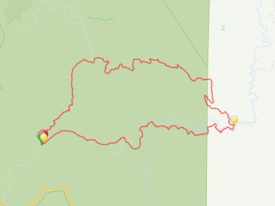
Here’s a more detailed map of Toolangi. I’ll add some further points of interest, enlarge the list of steep tracks and maybe add some photos too. But seriously, just go out there and have fun. Discover it for yourself!
Please read the disclaimer I posted with the overview map. This is data created on a computer, for the most part, you can download the .kmz or .kml files for any layer or all of them and use these to navigate on a device (there are online services to convert to .gpx if that is what your device uses) – this is only supposed to be an inspirational guide.
You need to take care of yourself in the bush. GPS applications are battery intensive, I would suggest taking a paper map and compass. Know where you are, where you’re going, tell someone, you can have fun and be safe at the same time.
[googlemaps https://www.google.com/maps/d/embed?mid=103TrDqUT5ZokKPDOVo0jpGFBhRk&w=640&h=480]


