Check this out!!!
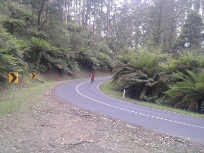
Do your research before you head out and take good quality maps that work without an internet connection. I still use paper and always carry a compass. Almost all of these direction sets include 4wd trails that are going to be most comfortable on a dual suspension xc bike. Hardtails and fat bikes are also great options. Tell people where you are going and when you expect to be back, despite being so close to Melbourne a lot of this forest is rarely visited and you may be the only person to visit a particular track that week.
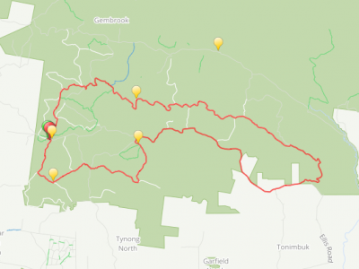
It is extremely exciting to see the detail level Google has available. Follow a track at a sufficient zoom and you will see there are thousands of kilometers of tiny forest tracks not included in these direction sets you can explore. I envisage being able to more create detailed exploration sets for smaller sections of forest. Give me a few weeks/months. Consider this map a chunky overview of the proposed GFNP including some rides I have done and some I haven’t. It is not exhaustive but many tracks are exhausting!!!
DISCLAIMER:
I take no responsibility for the accuracy of this data. The data in this map is subject to change at any time without warning as I add, remove and update these tracks. Most of this data was constructed remotely from a computer. It is designed to be use as an inspirational guide rather than a reference map in the forest. Some forest tracks are seasonally closed (roughly from June to November) or may be closed due to ‘tree harvesting’ (forest destruction) operations, so be prepared to detour and or backtrack. Take responsibility for your own safety in the bush. Be prepared for the unexpected. Carry plenty of water and enough tools and spares to fix your bike, because there aren’t any bike shops in the middle of the forest. Don’t ride sections you are not comfortable with, be aware and respectful of your limits and the limits of the bike you are riding. The last thing you want to do is have to hike out, two general tips in that unfortunate eventuality, head up to get mobile reception and head down to find water.
[googlemaps https://www.google.com/maps/d/embed?mid=16eO65ggHG_Cesq21zbh39xKApvM&w=640&h=480]
The map itself can be downloaded in layers or in one file from the drop down menu and exported to .kml format. There are free online services to transform this into .gpx (interchange format for phones and portable devices). This is a work in progress and not a finished resource. If you would like to help with this process, riding these ‘breadcrumb’ trails with a recording GPS device and then sending through actual field data would be amazing. I would like to find a better platform to share this data so crucial information like elevation profiles are visible, but until I can transfer to wordpress.org I don’t think this is possible but I would love to be enlightened!
Happy riding!
If you have any feedback please get in touch!