Not a fan of tents? No problem. This ride should take around 3-6 hours depending on how many breaks and side trips you take. Scroll down for a complete description. The map was made with ridewithgps.com and it can generate a free cue sheet if you want one. A .gpx file can also be downloaded which is compatible with many GPS devices and applications.
If you’re going riding in the #GFNP why not read some tips on how to share your journey and inspire others?
Disclaimer:
This track was generated on a computer and like all information on this website should act as a guide only. Ride at your own risk, be prepared. Take topographic maps, plenty of water and tell somebody where you are going.
Elevation Gain: 980m
Highlights:
- Buttongrass Nature Walk
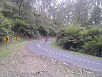
- Most of these tracks are off limits to cars, so you can ride in ease and total comfort. Be the king of the road!
- The Four Brothers Rocks
- If you were so inclined, this route can be reached in 1-2 hours ride from Belgrave/Pakenham stations. If you intend to do this as a return trip all in one day, start early and take lights.
Surface conditions and wheels required:
This route is all gravel roads and 4wd trails apart for a short stretch near the end on tarmac. Most of it is off limits to motorized vehicles. The surface is great, but can become difficult in wet conditions. The track wasn’t built for bicycles so there are some short rough sections and some short steep inclines/descents. There may be mud, depending on the weather. There is no single track, although there are some steep descents possible from Burgess Road. A cross-country mountain bike is ideal but a sturdy cyclocross*, hard-tail or fat bike would also do the trick. I have done part of this route on a road bike and it wasn’t smart, do not recommend. The starting point is easily accessible in a 2wd all year round.
*The final section, south of the Gembrooke-Tynong/Tonimbuk roads (encountered after the Buttongrass Nature Walk ~32km) is rougher and steeper than the section north of it and I don’t recommend riding a cyclocross or skinny tires here. If you are feeling spent by this point it’s probably not worth it either, there are some short steep climbs you will be pushing/carrying a bike up. The alternative is to stick to the main road, you’ll be back at the picnic ground in no time.
Map:
Description:
Jump the gate at the top of the Mortimer Picnic Ground (or carry your bike over it if you are not a pro trials rider). You’re on Triangle Track, follow it uphill for a little over 1km. Take the left onto Windy Point Rd and follow it until you get to a gate onto Link Rd. Back into car country, follow Link Rd in a northerly direction for a few hundred meters before following the signs to Four Brothers Rocks up Burgess Rd. You will need to climb over another horse trap and not far beyond here you will see an opening to the left of the track with some bollards to mark the spot. This is Four Brothers Rocks, it is an ancient site, enter with respect. Continue along Burgess Track for another 10-12km. Turn right onto Towt Rd and then Jolley Rd. Take the major Tonimbuk road right and stick with it for another 8-10km. Take a left at Camp Rd – here is the access point for the Buttongrass Nature Walk – followed by a left onto Guide Track (Read the *note above in wheels. After a few km turn right onto Luptons Track and follow it with a sharp right onto the larger Tynong North Rd. Take the left onto Cannibal Creek Track and after 2km turn right onto Sand Pit Ridge Rd. Follow this for another 2km before taking a right at Yarrabubba. Yarrabbubba will take you back down to the main road, take a left at the main road and you will get to the picnic ground you started at within a minute or two.
Easy Alterations:
- Park or camp at Nash Creek Camping Area (on map, slightly off route)
- Ride in reverse.
- Shorten the route by taking a route down off the RHS of Burgess Rd down to Tonimbuk Rd – these look steep and I have not ridden them – or by staying on Tonimbuk Rd back to Mortimer Picnic Ground.
Map and Route Notes:
- This route has not been calibrated in the field.
- If you’d like a slightly longer ride that goes through Bunyip, and connects to the Ada Tree check out this one.
- If you encounter anything interesting on the route, or record an actual GPS file from the field, please get in contact.